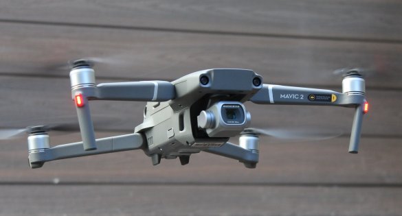
Drones add sting to Green Scorpions monitoring and enforcing capabilities
The Western Cape Department of Environmental Affairs and Development Planning recently strengthened its environmental enforcement capacity with the addition of drones and drone pilot training to its Green Scorpion Unit.
Anton Bredell, Minister of Local Government, Environmental Affairs and Development Planning said: “As pressure increases on our natural ecosystems, our obligation to monitor and enforce environmental legislation becomes even more important. At the same time, we must work within constrained budgets and with limited manpower. As such, any new technology, such as drones, which can strengthen our efforts, should be embraced.”
The Department invested R250 000 to train and qualify 9 Green Scorpions with Remote Pilot Licenses (RPL). This will enable them to legally use drones during their field work. The RPL qualification system is informed by the Civil Aviation Act of 2009 and Civil Aviation Regulations of 2011. All 9 pilots who signed up for the training passed the intense 3 week required validation examinations and practical and are set to use this technology going forward.
Ayub Mohamed, a Chief Director at the Department of Environmental Affairs and Development Planning said drones have introduced new and effective ways of using existing technologies and allow for different ways of working to improve productivity and efficiencies.
Drones can enhance desktop investigations and intelligence gathering through aerial imagery. This is helpful, as alleged unlawful activities as received from complaints need to be confirmed and verified through site inspections.
Drones also provide an added dimension during site inspections, in the form of an aerial view, and then also in situations which are inaccessible on foot. Technology allows for drone footage to be used in measuring and tracking the extent of the unlawful activities or the severity of environmental pollution and/or degradation on the site.
Environmental impacts are often difficult to assess and convey from ground-based pictures. Viewing from above allows a holistic view in relation to the surroundings. Aerial photographs and 2-D maps reveal details such as relative scale, location, and prevalence, while 3-D maps allow for volumetric calculations such as, excavation depths, stockpile of infilling material calculations, slope calculations and other compliance factors.
Drones have also proven to be beneficial from a safety and risk aversion perspective, especially in high-risk areas and areas prone to social unrest, or dangerous and inaccessible terrains. Officials can now position themselves at a safe location from the site (within radius of the drone) or a safe area on the property and operate the drone to capture aerial imagery and collect evidence safely without endangering themselves.
The Department of Environmental Affairs currently has two DJI Mavic Air 2 S drones, and has successfully used them in compliance monitoring exercises, to combat illegal clearing of indigenous vegetation in the Cape Winelands area, during joint intergovernmental blitz operations, as well as collecting evidence and conducting fieldwork for investigation purposes.
Ends
Contact:
Wouter Kriel
Spokesperson for Minister Anton Bredell
Western Cape Minister of Local Government, Environmental Affairs and Development Planning
079 694 3085


